 vesseltracker.com
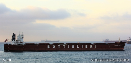
Vessel MINOAN HILL IMO: 9471642, MMSI: 229870000 Bulk Carrier
UTC, 25.25127, 55.26516, course: 131, speed: 0
UTC, 25.25124, 55.26516, course: 131, speed: 0
2026-02-14 04:06:26 UTC, 25.25126, 55.26519, course: 131, speed: 0
Live AIS position:
UTC. Near Dubai),
updated 2026-02-14 04:06:26 UTC.
Find the position of the vessel MINOAN HILL on the map. The latter are known coordinates and path.
marine traffic ship tracker show on live map
The current position of vessel MINOAN HILL is 25.25126 lat / 55.26519 lng. Updated: 2026-02-14 04:06:26 UTCCurrently sailing under the flag of Malta
MINOAN HILL built in 2011 year
Deadweight:
93258 tDetails:
Last coordinates of the vessel:
UTC, 25.25126, 55.26516, course: 131, speed: 0UTC, 25.25127, 55.26516, course: 131, speed: 0
UTC, 25.25124, 55.26516, course: 131, speed: 0
2026-02-14 04:06:26 UTC, 25.25126, 55.26519, course: 131, speed: 0